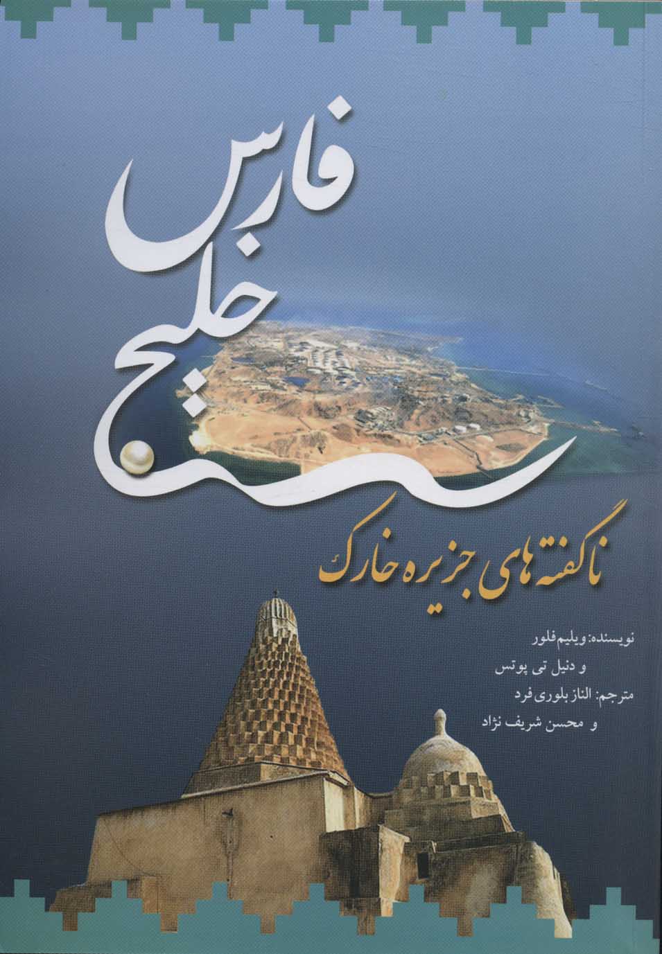
خلیج فارس ( ناگفته های جزیره خارک ) فارسی 1400
Khalīj-i Fārs ( nāguftah'hā-yi Jazīrah-i Khārk )
210 SEK

اشتراکگذاری
Wishlist
عنوان اصلی:
Khark: The Island's Untold History
شابک:
9786222671112
مترجم:
Ilnāz Bulūrī Fard
ناشر:
Nigah
گروه سنی:
بزرگسال
صفحات:
333
وزن:
435 g
ابعاد:
18 x 25 cm
جلد کتاب:
شومیز
The island of Khark was an important link in Persian Gulf navigation, supplying passing ships with water, victuals, and pilots for ships sailing to and from Basra. This was why the Arabs called Khark "the Mother of Skippers" (Umm al-Rubbaniyan). Through the ages, Khark has also been a place of pilgrimage: in Sasanian times, due to the presence of an early Christian church and monastery, and in Islamic times, because of the presence of the tomb of Mohammad al-Hanafiyya.
In the eighteenth century, the Dutch made the island their center of trade in the Persian Gulf, and by the nineteenth century the island was dubbed "the most important strategic point in the Persian Gulf," reason why the British occupied it twice. Although by 1900 the island had lost its strategic importance, it acquired it again after the 1950s, when the National Iranian Oil Company decided to make Khark its main terminal for the export of crude oil. Later, chemical factories were added to the island's economic make-up. As a result, Khark's name is now better known around the world than it was ever previously, but the history has remained untold. This book tells the whole story, from the early archeological evidence and the Islamic and Safavid periods, to the Dutch projects in the eighteenth century and the British in the nineteenth century. And in the end, how the traditional way of life ended and industrialization began.
more
در زبان فارسی این جزیره خارک نامیده می شود، اما عرب ها آن را «خريج» می نامند. جزیره کوچک تر نزدیک به آن «خارگو» نام دارد که عرب ها آن را «خوایریج» می نامند. این در حالی است که اروپایی ها آن را «کور گو» یا «کورگو» می نامیدند. این جزیره سنگی ۳۱ کیلومتر مربع مساحت دارد و در ۵۵ کیلومتری شهر بوشهر و ۳۲ کیلومتری بندر ریگ واقع شده است. جزیره خارک از شمال به جنوب ۶۰۶ کیلومتر طول و ۴۸ کیلومتر عرض دارد. عرض متوسط آن حدود ۱۰۶ کیلومتر و تقریبا به شکل مثلث است. در سال ۱۸۳۰.م بومیان منطقه می گفتند که تمام جزیره را می توان در عرض پنج ساعت با پای پیاده طی کرد. بیشتر جزیره شامل تپه های بی آب و علف با بیش از ۷۶ متر ارتفاع است که در مرکز و جنوب خارک قرار دارند. در بخش های شمالی از اختلاف سطح آنها کاسته و به پرتگاه هایی به ارتفاع ۶ تا ۹ متر منتهی می شود. کوههای سنگی و سنگ آهک، چشم اندازی متروک را با زمینی که شکسته و ناهموار است، عرضه می دارند. تپه ها پوشیده از یک برش آهکی لایه نازک است که زیر آن لایه ای ضخیم تر از بسترهای نرم تر قرار دارد و به آرامی توسط باد و باران فرسایش می یابد. تنها زمین پست، دشتی در حدود ۲ . ۶ کیلومتر مربع است که در قسمت شرقی جزیره قرار دارد و تا دهه ۱۹۵۰ در لبه آن یک روستا و مکان یک دژ قدیمی هلندی قرار داشت. قسمت پایین یک خاک شنی دارد. جزیره توسط یک صخره به عرض ۰ . ۸ کیلومتر احاطه شده است.
more